
Übersicht
An offshore operator needed a more efficient way to understand the condition of a fixed platform and prioritize future maintenance activities.
While existing inspection programs provided valuable information, the operator wanted a broader view of asset condition to help identify previously unknown defects, improve maintenance planning, and focus resources where they would have the greatest impact. At the same time, limited offshore bed space and ongoing production created pressure to complete the work efficiently without disrupting operations.
The goal was not simply to inspect the asset. It was to give the operator the information needed to make better maintenance decisions, reduce the risk of future failures, and plan repairs with greater confidence.
Unsere Lösung
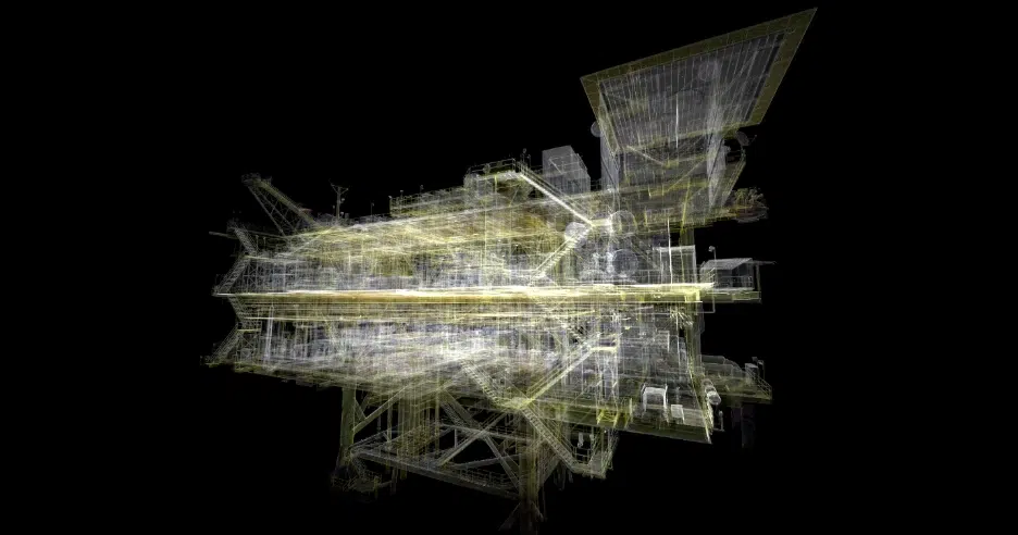
We deployed a two-person team equipped with advanced 3D laser scanning technology to capture engineering-grade data across the platform while production continued uninterrupted.
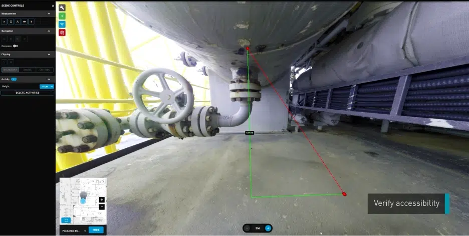
Over 13 days, the team collected more than 2,000 panoramic images and a highly detailed point cloud, creating a virtual representation of the asset that could be inspected, measured, and explored remotely. Scanners were positioned systematically throughout the platform to capture equipment from multiple angles. Elevated scan locations, telescopic systems, low-level tripods, and specialized mounting arrangements extended coverage above, below, and around equipment while eliminating reliance on scaffolding and rope access.
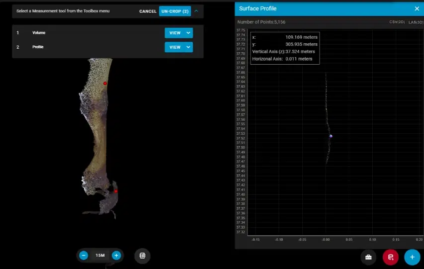
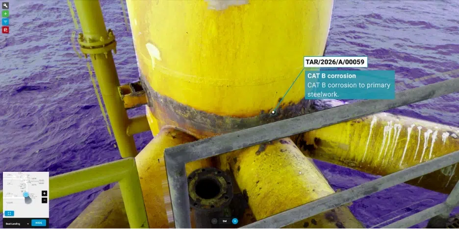
The data was made available through our Vision™ 3D Data Visualization Platform, giving inspection engineers and other stakeholders remote access to the same visual and dimensional information. Using the software’s high-definition point-cloud viewer, tagging capabilities, and point-cloud analysis tools, engineers completed a comprehensive external condition assessment. They could identify and spatially tag anomalies, connect findings to specific equipment, and develop inspection and maintenance work scopes within the digital asset environment.
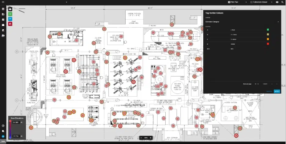
Rather than relying solely on predefined inspection locations, the approach captured a far broader picture of asset condition. This allowed the team to evaluate areas that may not have been included in traditional inspection scopes while creating a lasting digital record that could continue delivering value long after offshore data collection was complete.
Value Delivered
The assessment identified more than 200 anomalies across the platform, including previously unreported anomalies that warranted further investigation.
By capturing a more complete picture of the asset, the operator gained visibility into conditions that may otherwise have remained unidentified until a future inspection campaign.
More importantly, the project transformed inspection data into actionable maintenance and integrity information. Findings were categorized, prioritized, and linked to specific equipment. The Inspection team also provided recommended next steps based on the conditions observed, including targeted follow-up inspection, engineering review, fabric maintenance, component replacement, and further investigation of potential Korrosion unter der Isolierung. This gave the operator a clearer basis for defining future inspection and remediation work scopes rather than simply receiving a list of anomalies.
The engineering-grade point cloud also became a long-term resource for maintenance and engineering teams. Accurate dimensional data can support repair planning, replacement design, and future maintenance scopes without requiring additional offshore measurement campaigns. Following project delivery, the operator began exploring how the data could also support repair-order development and fabrication planning, extending the value of the digital asset beyond its original inspection scope.
By combining comprehensive data capture with remote inspection expertise, the project helped the operator:
- Identify and spatially tag more than 200 anomalies
- Uncover previously unreported asset condition anomalies
- Translate findings into prioritized inspection and maintenance recommendations
- Eliminate the need for additional dimensional control scans by providing comprehensive asset coverage for engineering use
- Maintain production throughout the campaign
- Support repair planning, replacement design, and future maintenance work scopes
- Create a reusable digital record of asset condition
More than an inspection project, the initiative gave the operator a clearer understanding of overall asset condition and the information needed to make more informed maintenance decisions. By uncovering issues that had not previously been identified and providing a detailed digital record of the platform, the operator can prioritize inspection, maintenance, and remediation activities before problems become larger operational risks.